


Descripción de Geographic Information System
The app is a complete free handbook of Geo Informatics System which covers important all topics with detailed notes, diagrams, equations, formulas & course material.
This App has 100 topics with detailed notes, diagrams, equations, formulas & course material, the topics are listed in 5 chapters. The app is must have for all the engineering science students
Download the App as a reference material & digital book for Civil & other engineering programs & degree courses.
The App is designed for quick learning, revisions, references at the time of exams and interviews.
This app cover most of related topics and Detailed explanation with all the basics topics.
Some of the topics Covered in this Geographic Information System app are:
1. INTRODUCTION OF GIS
2. GIS to Geocomputation
3. Technological Facilitation
4. BASIC FUNCTIONALITY OF GIS
5. A SYSTEM DEFINITION OF GIS
6. GIS Science and the Rise of Geo-Information Engineering
7. GIS SCIENCE TO FOLLOW
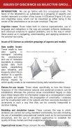
8. ISSUES OF GISCIENCE AS SELECTIVE GROUPING OF ASPECTS
9. INTRODUCTION OF CARTOGRAPHY
10. GEOINFORMATION TECHNOLOGY AND CARTOGRAPHY
11. COORDINATE SYSTEM
12. GLOBAL SYSTEMS
13. PROJECTION BASICS FOR GIS PROFESSIONALS
14. MAP SCALE
15. MAP PROJECTION
16. GEOMETRIC TRANSFORMATION
17. VECTOR AND RASTER DATA
18. SAPATIAL PHENOMENON OF GIS
19. SPATIAL DATA FUNCTION
20. DATA COLLECTION TECHNOLOGIES
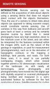
21. REMOTE SENSING
22. GROUND SURVEY
23. The Role and Nature of Environmental Models
24. CONTEXT OF ENVIRONMENTAL MODELLING
25. A SUMMARY OF MODEL DEVELOPMENT
26. APPLYING MODELS
27. MODELLING LANDSLIDES
28. MODELLING TOPOGRAPHY
29. TYPOLOGY OF MODELS
30. APPROACHES TO MODELLING
31. REPRESENTATION AND COMPUTATION OF GEOGRAPHIC DYNAMICS
32. TEMPORAL MODELLING
33. TEMPORAL GIS
34. DATABASE CONCEPTS
35. DATABASE DESIGN
36. DATA INPUT TECHNIQUES
37. DATA ENCODING
38. GLOBAL POSITIONING SYSTEM(GPS)
39. COMPARISON OF ENCODING AND DECODING
40. MAP LAYOUTS
41. MAP LAYOUTS ELEMENTS
42. COMPLETING MAPS AND SEQUENCES
43. SEQUENCING TECHNOLOGIES
44. MAPPING TECHNOLOGY
45. EVALUATING MODELS
46. MAP ALGEBRA
47. MAP ELGEBRA INPUT TYPES
48. OVERLAY ANALYSIS
49. VECRTOR AND RASTER OVERLAY
50. TARAIN MODELLING
51. SPATIAL INTERPOLATION
52. TRANSFER FUNCTION
53. GIS & ARTIFICIAL NEURAL NETWORKS
54. NETWORKS
55. GIS AND NETWORK ANALYSIS
56. WATER RESOURCE APPLICATIONS OF GIS
57. HYDROLOGIC MODELLING
58. GIS AND SOCIETY
59. GIS AND TRANSPORTATION
60. GIS BASED ASSESSMENT OF GEOTECHNICAL CHARACTIRISTICS
61. GEOTECHNICAL STRUCTURES
62. SPATAIL DATA GENERILAZTION IN GIS
63. WEB MAPPING
64. IMPORTANCE OF WEB BASED DESIGN
65. ENVIRONMENTAL IMPACT ANALYSIS
66. MAP SERVICE
67. ESTABLISHMENT AND DEVELOPMENT OF EFA MONITORING SYSTEMS
68. GIS IN UTILITY MANAGEMENT
69. THEMTIC MAPPING
70. Restructured-Accelerated Power Development and Reforms Programmed
71. GIS IN UTILITY MANAGEMENT
72. THEMTIC MAPPING
73. Restructured-Accelerated Power Development and Reforms Programmed
74. PHOTOGRAMMETRY
75. MOBILE MAPPING
All topics are not listed because of character limitations.
Features :
* Chapter wise complete Topics
* Rich UI Layout
* Comfortable Read Mode
* Important Exam Topics
* Very simple User Interface
* Cover Most Of Topics
* One click get related All Book
* Mobile Optimized Content
* Mobile Optimized Images
Each topic is complete with diagrams, equations and other forms of graphical representations for better learning and quick understanding.
This app will useful for quick reference. The revision of all concepts can be finished within Several hour using this app.
Instead of giving us a lower rating, please mail us your queries, issues and give us valuable Rating And Suggestion So we can consider it for Future Updates. We will be happy to solve them for you.
Geographic Information System - Versión 1.8
(24-04-2023)Geographic Information System - Información de APK
Version de la app: 1.8Paquete: engg.hub.geoinformatics.systemApps en la misma categoría
Quizá también te interese...


